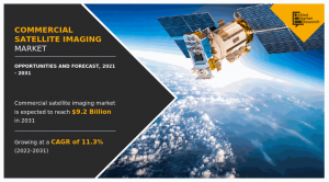
Rise in utilization of satellite imagery in government and defense sectors drive the growth of the global commercial satellite imaging market.
WILMINGTON, NEW CASTLE, DELAWARE, UNITED STATES, March 27, 2024 /EINPresswire.com/ — 𝐓𝐡𝐞 𝐠𝐥𝐨𝐛𝐚𝐥 𝐂𝐨𝐦𝐦𝐞𝐫𝐜𝐢𝐚𝐥 𝐒𝐚𝐭𝐞𝐥𝐥𝐢𝐭𝐞 𝐈𝐦𝐚𝐠𝐢𝐧𝐠 𝐌𝐚𝐫𝐤𝐞𝐭 𝐠𝐞𝐧𝐞𝐫𝐚𝐭𝐞𝐝 $𝟑.𝟑 𝐛𝐢𝐥𝐥𝐢𝐨𝐧 𝐢𝐧 𝟐𝟎𝟐𝟏, 𝐚𝐧𝐝 𝐢𝐬 𝐞𝐬𝐭𝐢𝐦𝐚𝐭𝐞𝐝 𝐭𝐨 𝐫𝐞𝐚𝐜𝐡 $𝟗.𝟐 𝐛𝐢𝐥𝐥𝐢𝐨𝐧 𝐛𝐲 𝟐𝟎𝟑𝟏, 𝐰𝐢𝐭𝐧𝐞𝐬𝐬𝐢𝐧𝐠 𝐚 𝐂𝐀𝐆𝐑 𝐨𝐟 𝟏𝟏.𝟑% 𝐟𝐫𝐨𝐦 𝟐𝟎𝟐𝟐 𝐭𝐨 𝟐𝟎𝟑𝟏. The report offers a detailed analysis of changing market trends, top segments, key investment pockets, value chain, regional landscape, and competitive scenario.
𝐑𝐞𝐪𝐮𝐞𝐬𝐭 𝐒𝐚𝐦𝐩𝐥𝐞 𝐏𝐚𝐠𝐞𝐬 𝐍𝐨𝐰: https://www.alliedmarketresearch.com/request-sample/1751
Satellite imaging offers geospatial products and services for most government agencies and defense authorities for security-related applications. With high image quality and precision, satellite imaging is a proven source of information for any government or defense authorities, which helps in maximizing security programs. In addition, the information extracted from satellite images helps the local governments to better assess real-life situations. This, in turn, contributes toward developing live-saving and property-protection programs and enhance the future economic stability of their respective communities.
Advantages such as precise mapping for mission planning, search, and rescue operations and rise in utilization of satellite imagery in government and defense sectors drive the growth of the global commercial satellite imaging market. Moreover, the introduction of new technologies such as electric propulsion technology, high-resolution cameras, advanced remote sensing technology, and others supplements the market. On the other hand, increase in usage of satellite data for development of smart cities and connected vehicles along with rise in implementation in commercial applications present new opportunities in the coming years.
𝐏𝐫𝐨𝐦𝐢𝐧𝐞𝐧𝐭 𝐌𝐚𝐫𝐤𝐞𝐭 𝐏𝐥𝐚𝐲𝐞𝐫𝐬
The key players analyzed in the commercial satellite imaging market include BlackSky, European Space Imaging, Galileo Group, Inc., ImageSat, L3Harris Technologies, Inc., Maxar Technologies Inc., Planet Labs Inc., Airbus S.A.S., SpaceKnow Inc., and Telespazio France.
𝐏𝐫𝐨𝐜𝐮𝐫𝐞 𝐂𝐨𝐦𝐩𝐥𝐞𝐭𝐞 𝐑𝐞𝐬𝐞𝐚𝐫𝐜𝐡 𝐑𝐞𝐩𝐨𝐫𝐭 𝐍𝐨𝐰: https://www.alliedmarketresearch.com/commercial-satellite-imaging-market/purchase-options
Some of the newly introduced technologies include electric propulsion technology, high-resolution cameras, advanced remote sensing technology, next-generation GPS satellites, Light Detection and Ranging (LIDAR) technology, hyperspectral sensors, and multispectral sensors. Apart from these, the most recently developed technologies such as aerospace digital signal processors and large-scale anti-radiation field-programmable gate arrays are projected to make real-time image processing easy and overcome the limitation in satellite imaging. If a similar trend is attained in the future, satellite imagery is expected to be the preferred choice in almost all commercial applications, which is anticipated to provide massive growth opportunities for the market growth. Furthermore, development in data transmission capabilities, improvement in geospatial processing, and scalable cloud-based platforms is expected to provide new growth opportunities.
Based on application, the geospatial data acquisition and mapping segment accounted for the highest share in 2021, contributing to more than one-fourth of the total Commercial Satellite Imaging Market share, and is estimated to continue its lead position during the forecast period. However, the defense & intelligence segment is projected to manifest the highest CAGR of 13.3% from 2022 to 2031.
𝐑𝐞𝐠𝐢𝐨𝐧𝐚𝐥 𝐀𝐧𝐚𝐥𝐲𝐬𝐢𝐬:
Based on region, North America contributed to the highest share in 2021, holding nearly two-fifths of the total market share, and is expected to continue its dominant share by 2031. However, Asia-Pacific is projected to portray the fastest CAGR of 12.9% during the forecast period.
𝐈𝐧𝐭𝐞𝐫𝐞𝐬𝐭𝐞𝐝 𝐭𝐨 𝐏𝐫𝐨𝐜𝐮𝐫𝐞 𝐭𝐡𝐞 𝐑𝐞𝐬𝐞𝐚𝐫𝐜𝐡 𝐑𝐞𝐩𝐨𝐫𝐭? 𝐈𝐧𝐪𝐮𝐢𝐫𝐞 𝐁𝐞𝐟𝐨𝐫𝐞 𝐁𝐮𝐲𝐢𝐧𝐠: https://www.alliedmarketresearch.com/purchase-enquiry/1751
Satellite images are used for urban management or planning and for smart city development. . Urban planners use satellite imagery datasets containing useful information regarding annotated objects data to understand settlement trends and ensure efficient infrastructure management. In addition, rise in use of remote sensing technology for zoning and city infrastructure modeling has helped in meeting increasing demands from city-based populations toward better management of sustainable urban development. In addition, growth in urban agglomeration and monitoring urbanization of adjoining areas to enable smart city planning and implementation is propelling satellite imagery adoption. Moreover, connected as well as autonomous vehicles leverage high-definition (HD) maps, seamless internet access, and roadside assistance during an emergency from space using commercial satellite imaging.
𝐊𝐄𝐘 𝐅𝐈𝐍𝐃𝐈𝐍𝐆𝐒 𝐎𝐅 𝐓𝐇𝐄 𝐒𝐓𝐔𝐃𝐘
By application, the geospatial data acquisition & mapping segment generated the highest revenue in 2021.
By end user, the government segment was the highest revenue contributor in 2021.
By region, North America contributed the highest revenue, followed by Europe, Asia-Pacific, and LAMEA in 2021.
𝐂𝐡𝐞𝐜𝐤 𝐨𝐮𝐭 𝐦𝐨𝐫𝐞 𝐫𝐞𝐥𝐚𝐭𝐞𝐝 𝐬𝐭𝐮𝐝𝐢𝐞𝐬 𝐩𝐮𝐛𝐥𝐢𝐬𝐡𝐞𝐝 𝐛𝐲 𝐀𝐌𝐑 𝐑𝐞𝐬𝐞𝐚𝐫𝐜𝐡:
Aerial Imaging Market – https://www.globenewswire.com/en/news-release/2021/12/09/2348758/0/en/Aerial-Imaging-Market-to-Garner-8-51-Billion-by-2030-Allied-Market-Research.html
Small Satellite Market – https://www.prnewswire.com/news-releases/small-satellite-market-to-reach-13-71-billion-globally-by-2030-at-16-4-cagr-allied-market-research-301471345.html
Nanosatellite and Microsatellite Market – https://www.prnewswire.com/news-releases/nanosatellite-and-microsatellite-market-to-reach-8-69-billion-globally-by-2030-at-14-9-cagr-allied-market-research-301474824.html
Aircraft Electrification Market – https://www.globenewswire.com/en/news-release/2023/05/05/2662272/0/en/Aircraft-Electrification-Market-Predicted-to-Reach-21-8-Billion-Globally-by-2032-at-13-5-CAGR-Allied-Market-Research.html
David Correa
Allied Market Research
+1 5038946022
email us here
Visit us on social media:
Facebook
Twitter
LinkedIn
![]()
Originally published at https://www.einpresswire.com/article/699118563/commercial-satellite-imaging-market-to-expand-at-a-cagr-of-11-3-will-reach-us-9-2-billion-by-the-end-of-2031


